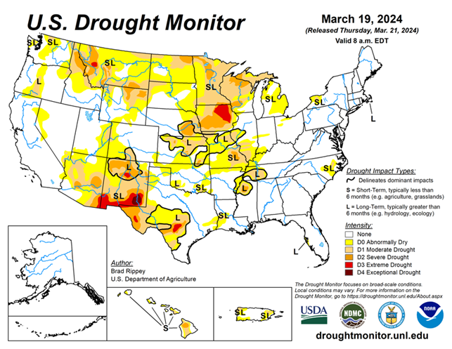
National Current Conditions: March 13, 2024 - March 19, 2024
Parts of the country saw improvements in dry conditions, including the Pacific Northwest and Four Corners states. The Plains and lower Midwest saw a mix of improvements and degradations. Much of the Upper Midwest remains in Moderate to Extreme (D1–D3) drought.
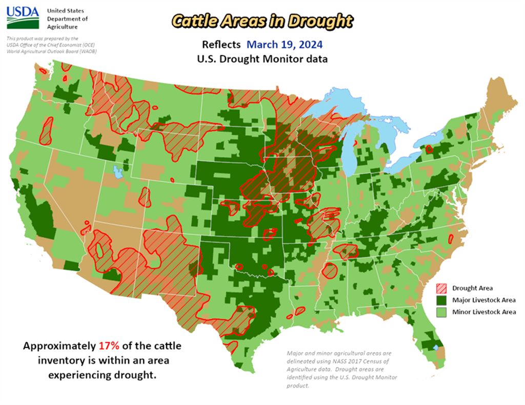
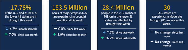
As of March 19, 2024, 17.78% of the U.S. and Puerto Rico and 21.21% of the lower 48 states are in drought, according to the U.S. Drought Monitor.
This Week's Drought Summary…
During the drought-monitoring period ending March 19, active weather shifted southward from the central Rockies and lower Midwest. Eventually, significant precipitation fell across much of the southern United States. Locally severe thunderstorms were most numerous from the southeastern Plains into the Ohio and Tennessee Valleys. Based on preliminary reports, the mid-March outbreak included more than three dozen tornadoes, one of which resulted in three fatalities in western Ohio on March 14. Meanwhile, the northern Plains and upper Midwest experienced mostly dry weather. Elsewhere, the southern High Plains escaped a short-lived round of windy, dry weather without any major wildfires, unlike the late-February episode. Recovery efforts continued in fire-affected areas, primarily across the Texas Panhandle, but extending to other areas on the central and southern Plains. As the drought-monitoring period progressed, record-setting warmth first retreated from the Midwest and Northeast into the Deep South, then appeared in the Northwest. By March 19, freezes deep into the Southeast threatened a variety of crops, including blooming fruits and winter grains. On that date in Alabama, both Anniston and Tuscaloosa posted daily-record lows of 28°F.
Looking Ahead...
Back-to-back storms across the northern United States should produce significant snow from the northern Plains into the upper Great Lakes States. The second storm system, expected to reach peak intensity over the weekend or early next week, has the potential to double season-to-date snowfall totals in parts of the upper Midwest. In addition, wind-driven snow from both storms could complicate rural travel and lead to hardship for Northern cattle, especially newborns. Separately, a late-week storm will produce rain in the southern and eastern United States, with 1- to 3-inch totals possible in portions of the Gulf and Atlantic Coast States. Elsewhere, cool, unsettled weather will return across the West, especially from northern and central California and the Pacific Northwest to the northern Rockies.
The NWS 6- to 10-day outlook for March 26 – 30 calls for near- or above-normal temperatures in the East, while colder-than-normal conditions will stretch from the Pacific Coast to Mississippi Valley. Meanwhile, wetter-than-normal weather will cover the entire country, except the south-central United States, with the greatest likelihood of wet conditions focused across the West and the Southeast.