National Current Conditions: January 17, 2024 - January 23, 2024
Temperatures are rising, but precipitation continues. This week brought more improvements across the Southern U.S., Midwest, western Northwest, and central Plains. Meanwhile, drought conditions in the eastern Northwest, northern Rockies, and northern Plains worsened.
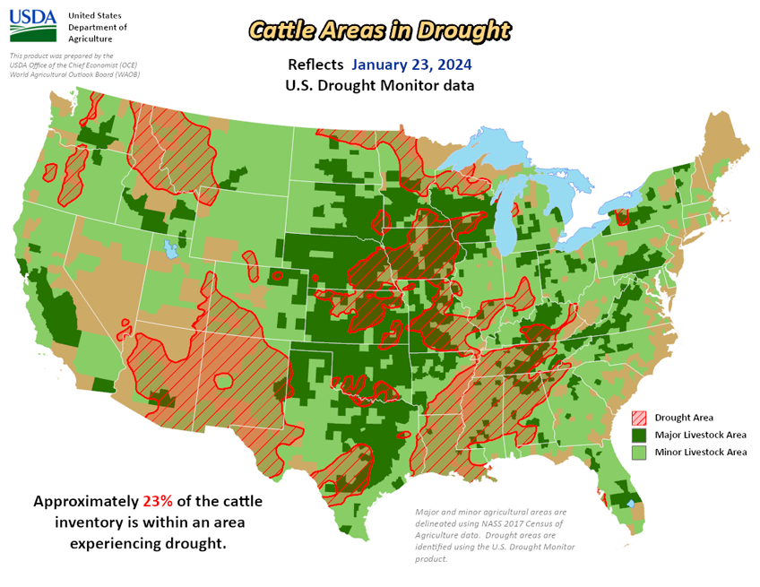
As of January 23, 2024, 22.95% of the U.S. and Puerto Rico and 27.38% of the lower 48 states are in drought, according to the U.S. Drought Monitor.


This Week's Drought Summary…
The current period was dry over most of the country with the greatest amount of precipitation occurring along the west coast and from east Texas into Arkansas. Temperatures were well below normal for most locations east of the Rocky Mountains, where departures were 5 degrees or more below normal for most areas. The greatest departures from normal were over Tennessee, Kentucky, and northern portions of Alabama and Mississippi where readings were 20-25 degrees below normal. The warm winter continued in the West with temperatures 5-10 degrees above normal over a majority of the region. The warmer-than-normal temperatures have been a challenge for snow accumulation with many locations, especially in the northern Rockies, having a very challenging start to the snow accumulation season.
With an active pattern through the central Plains into the Midwest the past few weeks, a reassessment of drought indicators was done in many locations this week to examine drought intensity levels and adjust where the data supported it. In most instances, drought remains but the data allowed for intensities to be reduced. The end of the period had an active pattern again developing in the southern Plains and into the South where widespread precipitation was anticipated after the data cutoff for this week. These locations will be assessed on next week’s map.
Looking Ahead...
Over the next 5-7 days, the active pattern over the South and Southeast will continue, with much of the region anticipating 3-5 inches of precipitation. The coastal areas of the Pacific Northwest also will remain active with the next system coming ashore. Dry conditions are expected over the central and northern Plains, northern Rocky Mountains and Southwest. Temperatures will flip back to a warmer-than-normal pattern for most of the country, with greatest departures above normal over the northern Plains and upper Midwest.
The 6–10 day outlooks show a high probability of warmer-than-normal temperatures over much of the U.S. during this period with the highest probabilities over the Plains and Upper Midwest. There is a high probability of below-normal temperatures over Alaska and much of Florida. The precipitation outlook has the highest probability of below-normal precipitation over much of the eastern third of the U.S. with the greatest chances over the Ohio River valley. There are above-normal chances of above-normal precipitation over much of the West and into the Plains during this time.