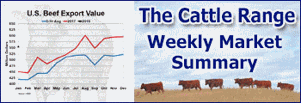
National Current Conditions: March 27, 2024 - April 2, 2024
This week brought a mix of mostly small improvements and degradations. Parts of Washington, western Kansas/Oklahoma, the western Ohio Valley, and Hawaii saw conditions worsen. Parts of Arizona, the Rockies, and the Midwest improved.
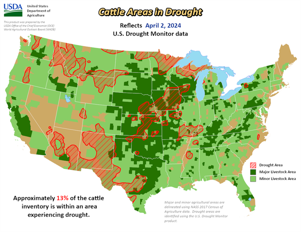
As of April 2, 2024, 15.12% of the U.S. and Puerto Rico and 18.01% of the lower 48 states are in drought, according to the U.S. Drought Monitor.


This Week's Drought Summary…
An active early springtime pattern continued through late March and into the beginning of April. A pair of low pressure systems and trailing cold fronts tracked across the east-central contiguous U.S. (CONUS). A swath of 1 to 3 inches of precipitation supported improvements extending from parts of the Midwest to southeastern Kansa and northeastern Oklahoma. However, moderate drought (D1) was introduced to the lower Ohio Valley which has missed out on precipitation during the late winter and early spring. Increasing short-term dryness and periods of enhanced winds led to expansion of abnormal dryness (D0) and moderate drought (D1) in southwestern Kansas, northwestern Oklahoma, and western Texas. March was relatively wet across Arizona where additional improvements were warranted before a drier time of year sets in later this spring. Below-normal snowpack supported an increase in D1 across the northern Cascades of Washington. 7-day (March 26 to April 1) temperatures averaged below (above)-normal across the western and north-central (eastern) CONUS. Alaska remains drought-free, while leeward sides of Hawaii had a broad 1-category degradation. Following recent improvement across much of Puerto Rico, no changes were made this past week.
Looking Ahead...
During the next five days (April 4-8, 2024), drier weather is forecast to overspread the Midwest and East behind a cold front. Another low pressure system is forecast to track inland to the West with another round of rain and high-elevation snow from California east to the north-central Rockies. Later on April 8, precipitation is expected to develop across the southern Great Plains and lower Mississippi Valley.
The 6-10 day outlook (valid April 9-13, 2024) depicts a pattern change by mid-April with a drying trend for the West. Below-normal precipitation is favored for this region along with the northern Great Plains. Elsewhere, across the central to southern Great Plains, Midwest, and East, above-normal precipitation is more likely. Above-normal temperatures are favored for much of the lower 48 states except for parts of New Mexico and western Texas where increased below-normal temperature probabilities are forecast.